


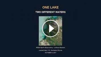
Lake Balkhash in Kazakhstan has an almost fresh western basin and a brackish-to-salty eastern basin. The Sarymsek Peninsula and narrow Uzynaral Strait divide the hydraulic regions and restrict mixing while allowing water exchange. The Ili River supplies much of the inflow to the western basin. The lake has no outlet; evaporation contributes to its water balance. This genuine natural-colour Landsat 8 OLI image acquired October 9, 2017 shows only the southwestern lake and Ili delta, not the entire lake or connecting strait. The milky water colour is likely suspended sediment and is not a direct salinity measurement. Original moving two-basin guide is conceptual, not to scale or a measured flow map. Still-image camera framing and labelled delta crop retain native colour. No drinking-water safety advice or current salinity values are asserted. Credit: NASA Earth Observatory / Joshua Stevens, using Landsat data from the U.S. Geological Survey. ESA 2022 article is used for geographic context only; its false-colour Sentinel image is not reused. No endorsement.
Original research-based WonderVexa Global documentary. Real media and explanatory illustrations are labeled on screen. American English male synthetic narration: Kokoro am_michael (Apache 2.0 model).
Sources:
https://science.nasa.gov/earth/earth-observatory/lake-balkhash-91230/
https://www.esa.int/Applications/Observing_the_Earth/Copernicus/Earth_from_Space_Lake_Balkhash
Image credits:
- Southwest Lake Balkhash Landsat8 October9 2017: NASA Earth Observatory / Joshua Stevens, using Landsat data from the U.S. Geological Survey, NASA EarthFAQ commercial editorial reuse withcredit, https://science.nasa.gov/earth/faq/
https://science.nasa.gov/earth/earth-observatory/lake-balkhash-91230/
Changes: resized, moving framing, editorial text and diagram compositing.
- Southwest Lake Balkhash Landsat8 October9 2017: NASA Earth Observatory / Joshua Stevens, using Landsat data from the U.S. Geological Survey, NASA EarthFAQ commercial editorial reuse withcredit, https://science.nasa.gov/earth/faq/
https://science.nasa.gov/earth/earth-observatory/lake-balkhash-91230/
Changes: resized, moving framing, editorial text and diagram compositing.
- Southwest Lake Balkhash Landsat8 October9 2017: NASA Earth Observatory / Joshua Stevens, using Landsat data from the U.S. Geological Survey, NASA EarthFAQ commercial editorial reuse withcredit, https://science.nasa.gov/earth/faq/
https://science.nasa.gov/earth/earth-observatory/lake-balkhash-91230/
Changes: resized, moving framing, editorial text and diagram compositing.
Video license: NASA EO / Joshua Stevens / Landsat USGS. Credited NASA editorial commercial reuse. Native colour/labelled delta crop/camera framing; no invented salinity map. ESA article text context only, no ESA or ORBIMAGE media used. Original script/two-basin guide, cached Kokoro am_michael/existing originalscore.
#Balkhash #Lakes #Geography #Landsat #Shorts
Original research-based WonderVexa Global documentary. Real media and explanatory illustrations are labeled on screen. American English male synthetic narration: Kokoro am_michael (Apache 2.0 model).
Sources:
https://science.nasa.gov/earth/earth-observatory/lake-balkhash-91230/
https://www.esa.int/Applications/Observing_the_Earth/Copernicus/Earth_from_Space_Lake_Balkhash
Image credits:
- Southwest Lake Balkhash Landsat8 October9 2017: NASA Earth Observatory / Joshua Stevens, using Landsat data from the U.S. Geological Survey, NASA EarthFAQ commercial editorial reuse withcredit, https://science.nasa.gov/earth/faq/
https://science.nasa.gov/earth/earth-observatory/lake-balkhash-91230/
Changes: resized, moving framing, editorial text and diagram compositing.
- Southwest Lake Balkhash Landsat8 October9 2017: NASA Earth Observatory / Joshua Stevens, using Landsat data from the U.S. Geological Survey, NASA EarthFAQ commercial editorial reuse withcredit, https://science.nasa.gov/earth/faq/
https://science.nasa.gov/earth/earth-observatory/lake-balkhash-91230/
Changes: resized, moving framing, editorial text and diagram compositing.
- Southwest Lake Balkhash Landsat8 October9 2017: NASA Earth Observatory / Joshua Stevens, using Landsat data from the U.S. Geological Survey, NASA EarthFAQ commercial editorial reuse withcredit, https://science.nasa.gov/earth/faq/
https://science.nasa.gov/earth/earth-observatory/lake-balkhash-91230/
Changes: resized, moving framing, editorial text and diagram compositing.
Video license: NASA EO / Joshua Stevens / Landsat USGS. Credited NASA editorial commercial reuse. Native colour/labelled delta crop/camera framing; no invented salinity map. ESA article text context only, no ESA or ORBIMAGE media used. Original script/two-basin guide, cached Kokoro am_michael/existing originalscore.
#Balkhash #Lakes #Geography #Landsat #Shorts
- Категория
- Балхаш Карагандинская область

Комментариев нет.
Следующее
-
00:17

Erling Haaland in Balkhash lake #haaland #balkhash #beach #балхаш
-
00:36
Kazakhstan Almaty Airport Lake Pierce #almaty #kazakhstan #travel #airport #nature #lake #mountains
-
01:33
#beach #balkhash #lake #kazakhstan #пляж #чубартубек #балхаш #озеро
-
00:13
Lake Balkhash #shorts #youtubeshorts #nature
-
31:31
Asia की सबसे खुबसूरत जगह Kaindy Lake , Kolsai Lake & Canyons | Almaty Kazakhstan Canyons Tour
-
00:12
Lake Balkhash 2026 #shorts #youtubeshorts #nature
-
00:16
Lake Balkhash 2026 #shorts #youtubeshorts #nature
-
00:11
Balkhash Lake #shorts #youtubeshorts #nature
-
00:14
Fishing, Lake Balkhash #shorts #youtubeshorts #nature
-
30:36
One Day Trip from Almaty | Kaindy Lake, Kolsai Lake & Charyn Canyon Complete Guide
-
00:56

Adorable Fennec Fox Snuggling Time Cozy Baby Moments PababaTV
-
00:57

Adorable Baby Seal Snuggling Time – Cozy Sleepy Moments | PababaTV #babyanimals #cuteshorts
-
00:57

Even Cuter! Sleepy Baby Fennec Fox Cozy Moments PababaTV #cuteshorts #cozymoments #babyanimals
-
00:52

Adorable Otter Snuggling Time – Cozy Sleepy Moments | PababaTV #babyanimals #cute #cuteshorts #funny
-
4:00:01

4 Hours of Soft Teddy Bear Lullabies | Sleep Music for Babies
-
06:38

Блогер Хан мен әйелінің видеосы қалай тарап кетті?
-
03:04

Жүсіп Ақшора & Дәурен Абиев – «Армандамын» / COVER SHOW СОҢҒЫ МАУСЫМ
-
03:48

Maksat Rahmet – «Мен – қазақпын» / COVER SHOW СОҢҒЫ МАУСЫМ
-
02:38

Bayansulu – «Байқа» / COVER SHOW СОҢҒЫ МАУСЫМ
-
16:31

«ҚЫЗДЫҢ ЖОЛЫ» телехикая. 45-бөлім
 Загрузка...

